Around Town (~10 miles)
To Plain And Lake Wenatchee (~25-42 miles)
Anjou Bakery Run (~30 miles)
To Blewett Pass (~40 miles)
West To Stevens Pass (~70 miles)
East To Stevens Pass (~16-22 miles)
Eagle Creek Canyon (~14 miles)
Apple Capital Loop (~10 miles)
Yakima River Canyon (~44 miles)
Waterville/Badger Mountain Loop (~?? miles)
Leavenworth to the end of the pavement on Icicle (Canyon) Road (and back), ~25 miles
This is a simple ride, consisting only in heading down Icicle Road until its pavement's end. That's pretty appealing, as Icicle Road conveniently runs along the north and west side of Leavenworth, with the town disappearing in a heartbeat or two as you cut up into the mountains. Better still,starting at about three miles from U.S.-2, Icicle Road begins to follow Icicle Creek up Icicle Canyon: even I can't get lost on this one. Indeed, about the only thing to consider in heading up such a tight canyon is how the temperature can easily drop ten degrees in a dozen miles - while also clouding up or even raining significantly. It happens.

Meanwhile, outside of the lone business on this road (serving up coffee, ice cream and more, that'd be Sleeping Lady Resort, located at just past mile 2; it offers a high quality at matching prices, fortunately compensated by having pretty, bucolic, and artistic grounds), Icicle Road is notable chiefly for being home to a number of entry points into the Alpine Lakes Wilderness. It's from Icicle Road that so many hikers and climbers come to check out Snow Creek Wall, the Enchantments, and any number of interesting rocks and sections of b-lurbling brook/roaring river (depending on the season). Here, then, are the points of note:
Mile 2.5 Sleeping Lady Resort; eats, drinks, sculpture, and river access
Mile 3 Icicle River RV Park


Mile 4 "dense" development pretty much ends here and some pullouts begin for climbers
Mile 4.25: Snow Lakes Parking Lot/Trailhead - to access the Enchantments from the low side

Mile 4.25+: seasonal road barrier; irrigation district earthworks, dams, controls, etc.
Mile 4.5 Wenatchee National Forest and Alpine Lakes Wilderness pullout and info sign; climbing now begins as road degrades
Mile 5: climbing becomes more vigorous, better rock climbing pullouts section begins
Mile 5.5: significant rock climbing pullouts to left still, plus unmarked access road for same to right
Mile 5.75: private bridge can be viewed over river
Mile 6: still more climbing pullouts
Mile 7: large Eight Mile Campground, climbing pullouts decrease substantially

Mile 7.5: view toward the cut that takes you to the Enchantments

Mile 8: junction to access Eight Mile Trailhead, three miles up a dirt road to the left - to access the Enchantments from the high side via Colchuck Lake and Aasgard Pass


Mile 8+: here begins a mile-plus of "No Overnight Camping" markings, nevertheless appealing river pullout spots to picnic
Mile 9.5: Fourth of July Trailhead - to access the steep trail up to Icicle Ridge

Mile 10: nice view overlook
Mile 10.5: rough RV camping, group camping (reserve) spots
Mile 11.5: Lower (left, river) then Upper (right, creek) Johnny Creek Campgrounds


Mile 12.5: end of pavement; a bridge to the left can be used to access a dirt road that climbs up for several miles via switchbacks
DIRECTIONS: Icicle Road hits Leavenworth at US U.S.-2 in a T on the north/west approach to Leavenworth, at the gas station. Follow the road out of town, continuing until the pavement ends (or one can continue beyond equally as far, if willing to put up with dirt track) - there's nothing more to it!
Leavenworth to the end of the pavement on Eagle Creek Canyon Road (and back), ~15 miles
This one's on the short side, a climb up a canyon past a few nice homes, but there's not much to say about this ride otherwise. Well, this: The road's in fine-enough condition, traffic is about non-existent, and overall it's a steady-yet-not-challenging climb. There are only a handful of very brief drops to break things up from the easy ascent. From the Chumstick Highway, at about 1200ft of elevation, the climb to the end-of-pavement spot is about 700ft.
As for the amenities, the canyon is green and beautiful. It's well-forested to its sides, primarily because of the governmental parklands that lie above any of the properties that front the road. As for the buildings themselves, it's an odd mix of trophy homes, old homesteads (which are far more picturesque if unfortunately less common), and the random trailer home.


Hmmm... what else... Well, the Eagle Creek Winery is about 2.5 miles into the journey up the canyon, with a tasting room that might beg a stop some day. There's also the Eagle Creek Ranch (think horse or sleigh rides, not overly inviting to a leave-'em-animals-alone kinda guy like me), which comes just before the pavement ends at about 5.5+ miles down (well, up) the road. And... that's IT, unless you want to get on a mountain bike and try out the Eagle Creek Canyon MTB Loop past the pavement - for which there is a local map, *somewhere*.


That's ALMOST it, anyway. Okay, more! There are ALSO some nice views of snow-peaked mountains that pop out here and there on the way back. That's because the drop to get back out of the canyon seems rather greater than the climb would indicate going in. Also, there's a barn between mile markers 3 and 4 that's well worth a sketch, if not just a picture. I flicked a nice-sized snake off of the road there once.
Bottom line: Call this one a nice spin in the country without the commitment of making it to Plain or Lake Wenatchee - nor with the traffic of heading down or up U.S. 2. That's good enough in my book!
DIRECTIONS: Chumstick Highway leaves Leavenworth from U.S.-2 at the light near the bridge just south of downtown Leavenworth, by the Bavarian Bakery and Dan's Market. Follow the road out of town, then take a right 1.5+ miles later onto Eagle Creek Canyon Road. Follow that out about 5.5 miles - until the pavement ends. The Eagle Creek Winery is around 2.5mi in, followed by the "biggest" climb section to get the mile marker 3; mile marker 4 comes right after a pond to the right not long after that. Returning to town is straightforward, plus this ride can be easily added to by taking a left on North Road whilst returning on the Chumstick (to head out to Peshastin with a return on U.S.-2, add about eight more miles).
Leavenworth to the Anjou Bakery (just past Cashmere on U.S.-2), about 30 mi
Here's a ride for the ages. Well, let me rephrase that. Here's a ride that should attract all ages, what with its destination-driven format that's proven so solid through the ages (or at least the age of cycling, to be specific). That's because, at its core, there lies that simplest of prospects in a ride: a goal-line target to tag and return from, moreover one that contains a reward that sufficiently congratulates the journey.
Simple, no? YES: A ride to that vaunted, mythically sudsy brewpub or coffee/coffee-cake-laced bakery IS perhaps the most traditional of routes. It's ingenious, too, because in its purest form it beautifully matches the lure of a wondrously circuitous route with the inevitable bonus that even Pavlov's dog would appreciate for the effort. Why ring a bell when there's food and drink instead?
In this particular case, said reward comes in the form of a pastry and coffee at the Anjou Bakery, a decidedly French place (i.e. the language of butter is taken seriously) which has held my devoted interest since the first time I walked through its doors to sample its offerings. To a crumb and a drop, it's hands-down the best bakery on this or any other side of the Wenatchee Valley. Sure, there isn't a whole lot of competition hereabouts, but I'd ALSO wager its success in a more cutthroat area of bakery aficionados like Seattle or San Francisco.
Anyway, with the above sufficing for a setting of table, this merely leaves... getting there. Ah, that! Well, here let me point out that there IS a quick way to the job. That'd be to just get on U.S.-2 (the Wenatchee Valley's main drag) in Leavenworth, heading east for all of about 12-13 miles. Our famous bakery is easily found situated just off to the right of the highway, between Cashmere and Monitor in an old farmhouse. Further simplifying matters, the bakery's even properly warned about with a highway "attractions" sign not long before it.
But that'd be the EASY way, and we'll have none of that, will we? NO! Plus, who likes busy highways if they can be avoided? IN ADDITION, MOREOVER, and BESIDES: there are numerous orchards that make for nice scenery to cut through. Now, with such improved thinking to thusly add miles to what was a formerly pedestrian journey, a quality ride is born.
Yes, welcome to a ride that finds itself mostly amidst apple, pear, and cherry trees in various stages of their annual production, plus the random roadside sculpture or objet d'arte - intended or otherwise. It's got a couple of towns so sleepy - Peshastin and Dryden - that no one probably owns an alarm clock in them. Another, Cashmere, is only now quite belatedly trying to go the way of the Methow Valley's Winthrop over time, jamming in a bit of Ol' West tomfoolery that might attract some tourists - starting with a whisky distillery to get the spirit(s) in the right place.
But outside of mentioning said attractions, the only thing to add to the overall appeal is to say it's kinda nice to stay on one side of the highway going and the other returning. You ARE basically just following U.S.-2 to a side, remember, so it's not like you can really get lost. That's awfully convenient. Below is MY preferred version of zigging the zag to the bakery...
DIRECTIONS (TO):
1) Start at where the Chumstick Highway departs from Leavenworth, at the light just west of the town's U.S. U.S.-2 bridge over the Wenatchee River. This is also the location of the Bavarian Bakery (try the poppyseed claw for a sweet, or a sesame seed brotchen or carraway roll for a savory) and Dan's Market (for about anything else food/drink-wise).
2) 0.5 mile later, take a right on North Road ("the Chumstick", meanwhile continues on to Plain, Lake Wenatchee and Seattle - even if you aren't!)
3) Shortly after passing the Amtrak station (which can take you to Seattle - or even directly to Chicago, of all places), continue enjoying the ensuing 3.7 miles of orchards, the random outsized trophy house bragging of Seattle wealth, or possibly misplaced vineyard (that'd be Icicle Ridge Winery, actually one of the better such venues, nevertheless oddly named since it's not actually under Icicle Ridge but merely has a rather distant view of it). Eventually you'll see businesses on the left while eyeing parallel train tracks slightly above on the right, shortly finding yourself crossing with the right of way underneath the tracks when the arterial road you are on bends right. Welcome to the rest of Main Street, Peshastin.
4) Cut 0.3 miles through the center of Peshastin, intersecting U.S. U.S.-2 at a traffic light just after crossing the Wenatchee River. If it's Spring or Summer, there's a decent chance you'll see rafters moving along below you on the river. Whatever the season, if you're hungry there's taco truck dead ahead of you.
5) Take a left onto U.S.-2 to head east.
6) Stay on U.S.-2 for a mile or so, passing over the junction onto U.S. Highway 97 South (which leads to Blewett Pass and Cle Elem).
7) Just past where U.S.-97 merges with U.S.-2 you'll cross a bridge with no decent shoulder (!!!) to take a right onto Deadman Road, whereupon also lies Tumwater Drilling Co. - should you be in the mood to purchase long segments of pipe to take along your ride for whatever reason.


8) Assuming you aren't in the mood for drilling supplies, instead head up and over Deadman Hill, a jog of ten-plus minutes, possibly noticing some views across U.S.-2. Or, whilst flying on your way down, see if you notice the large horse sculpture made up of horseshoes against the road as you scream past it. (It's much easier to take in this welded work of art if doing this route backward, chugging up the hill with plenty of time to pant and take in such details.


9) Continue following the right-of-way, again nearing U.S.-2, eventually finding that the road you are on is Pine Flats Loop. You'll pass Goehner branching off to the right, then Kinney to the left, then Heimbigner to the right as you ignore all three. Continue instead without turning, soon heading slightly up into the pear orchards as you briefly head away from U.S.-2. This road will eventually come to a T, with Half Road branching off to the right as you instead take a left - which keeps you on Pine Flats Loop. Similarly, you'll shortly top out only minutes later at a sharp left curve under a house, where you'll again follow the obvious left to stay on the right-of-way and return via a nice-n-speedy drop of downhill toward U.S.-2 again.

10) At the bottom of this quick descent (slow down or else!), you'll come to a T with Stine Hill Road. Here take a right and head up and over the above-mentioned hill over a couple miles. Views will become nice and sweeping to the left as you top out near a pullout with a farm implement that almost seems like a rest stop. And maybe it is - yours!


11) As you continue on Stine Hill Road, it'll become Sunset Highway at some point. Whatever the name, it'll also rather conveniently take you straight into Cashmere, eventually slicing right between some large apple warehouses after passing some Mexican-focused stores and restaurants. You'll notice that almost all of the workers on this entire trip are Mexican, by the way, a proof that is sometimes oddly invisible in this seemingly lily white valley that is actually 35% Mexican or so. The guy that almost took me out once with his pickup truck in a near head-on collision, however, was decidedly un-Mexican, or that's the best I could tell as this Gomer Pyle-looking dude only swerved at the last second to not spear me onto the road for the County Fairgrounds.


12) When you next come to the T practically in the heart of Cashmere, take a left onto Division Street and shortly cross over the train tracks. In a block or so past them you can see some of Cashmere's newer businesses and even a wall mural before continuing a hair further to take a right on the main drag, Cottage Street. Now THIS is Main Street, U.S.A. (the flags on every post are a giveaway), and probably will serve well in Cashmere's slow-but-steady transformation into another Winthrop - albeit one that's half as far from Seattle. (If wanting to shortcut the Anjou Bakery Run a hair, a stop at Weeds Cafe a long block or so down Cottage Street is a good bet - they have the best shortbread cookie I've ever had. Similarly, when you crossed over Mission Street a block before taking that right Cottage, you could also have taken a right onto Mission instead to imbibe either coffee at J-5 or whiskey and more at It's 5 O'Clock Somewhere - or Cashmere Public House #1. You would then move to #6 on the return trip if officially skipping out on the bakery. These things happen...)


13) On Cottage, next you'll pass through the brief downtown to find yourself in the supposedly historic Cottage District. It looks like only like a street that could pass as typical in any of the older and humble streets of Seattle, but hey - it's old and classy for Cashmere's otherwise offerings of trailer and ranch homes.


14) Cross over the Wenatchee River yet again, passing by Pioneer Village to your right (tourist trap? history lesson? who knows?), and take a right onto the frontage road just past Rusty's burger stand (a well-known traditional, old-school burger stand in the valley that has a counterpart in Wenatchee).
15) Very briefly continue alongside U.S.-2 on the frontage road, veering left when it essentially ends in a large parking lot and gas station in veer onto the smallest of bicycle paths to the left. This one-minute-minus trek will serve to get you up onto U.S.-2's shoulder (after passing the potentially strategic Martin's grocery store).
16) Zipping along U.S.-2 for a minute or two, hang the first right available onto Old Monitor Road, the one that comes just before the new-ish apple warehouse.


17) Follow Old Monitor around the bend - where one of the local rafting companies pulls its rafts out of the Wenatchee - and continue practically until you hit U.S.-2 again. But DON'T: The bakery is to your left! Coffee, pastry, water! How many shots of espresso can the human body take? Good question. Then wonder: Why is there a phony windmill? When was this really a barn? Why is this coffee so good? Do I really have to ride back, like today? Yes, you do.


DIRECTIONS (TO RETURN - WHICH YOU REALLY SHOULD CONSIDER DOING)
1) Take Old Monitor Road west, just like how you came, until it intersects U.S.-2. Admire the growing collection of metal sculptures accumulating at Osprey's river rafting take-out/orchards entrance - or a possibly changing sky from fire in the valley (which is the case in the following picture, from the Mill's Canyon fire of 2014).

2) In a slight deviation from the norm of riding with traffic, take a left onto U.S.-2's shoulder to your left without crossing the highway, following the shoulder heading east on the same strip that you came in on. Yes, it's the wrong way, but it's a broad shoulder and you'll be on it only ever so briefly before you...
3) Take the same super-short bike path to the left as before, the one seen before Martin's Market.
4) Follow the service/frontage road west, paralleling U.S.-2, to retake Cottage Road (0.25 miles or so) by turning left.
6) Again cross over the Wenatchee River after passing Pioneer Village by to once again mosey through the amazing historic Cottage District and on into "downtown" Cashmere. This time, however, you'll take a right onto Division to pass by the (thumb's-up!) barbeque place called Country Boys. Again cross over the Wenatchee River on yet another bridge to run into U.S.-2 yet again as well.


7) Take a left onto U.S.-2, this time crossing over the oncoming lane to be on the proper shoulder to the right of the road and with traffic.


8) Continue on U.S.-2 for a mile or two, passing the light at Goodwin, and then take a right onto North Dryden Road. This is the back way around Dryden, vastly more scenic and pleasant as you pass through orchards after first passing by (Peshastin) Pinnacle State Park (day use only). No, I have no idea why it's a State Park with almost nothing to do there, but I guess it keeps off the grafiti or something. More importantly, seeing as I once went down this stretch of road right after they were chipsealing it, I can say firsthand (and with the passage of time) that you won't have the hassles I had the day when the tar stuff first gunked into my brakes before making tar mush of my shoe soles when I began to hoof it. A woman coming in the other direction took pity on me and returned me to U.S.-2 that day.


8a) Should you decide to detour at Pinnacle State Park, shortly appearing to your right, you'll probably be joined by about no one as you take ten minutes to hike up the short trail that offers some really nice views of the rocks and the central part of the Wenatchee Valley. You can go further for bigger views, but it'll take a good while for them to change significantly to merit the effort. As for the telephone and power lines that cross through the park by the rocks? THEY suggest that this was made into a state park as something of an afterthought.


9) State park pitstop or no, you'll eventually pass the pinnacles by when continuing on glorious North Dryden Road for a few miles. You'll pass the turnoff for Olalla Canyon just before some teeny fruit pickers' shacks, then roll by The Kings's place, with its collection of old Jeep-family vehicles and other junk that only lacks a mangy dog. The numerous "Keep Out" and "No Trespassing" signs are really quite unnecessary!
More importantly, you'll be running along the irrigation ditch that comes a long way down U.S.-2 to keep all of the apple, pear, and cherry trees happy. Sweeping views of the valley abound, too.

10) Finally, after a little more than three (handily marked) miles. you will cross over some train tracks, where you have two choices, or even three. (1) You can continue straight onto School Road, walking your bike onto U.S.-2 dead ahead when School Road bends to the left. (2) You can take a left just after the train tracks to proceed in front of the baseball diamond, crossing over school Road to hang a right onto Alice Road which will shortly dump you onto U.S.-2. (3) You can continue straight onto School Road, letting it bend you back toward Dryden, where you will take a right onto Alice Road to be dumped onto U.S.-2. All of these will see you onto U.S.-2 within a couple of minutes or so.


11) Take a right onto U.S.-2, soon crossing an old, crumbly bridge over the Wenatchee River. As the bridge is long enough, the traffic is crappy enough, and the sidewalk is crumbly enough, I often walk my bike across the bridge using the sidewalk. The benefit of said walk is that you might see some rafters in season. (Some of the pictures above come from river crossings if not taking North Dryden Road as I did on "chip-seal day".)
12) Shortly later past the bridge, when you see the frontage road peel off from U.S.-2 on a slight incline, take the frontage (Motel) road to your right as if going to the gas station you see ahead or the Big Y Cafe.
13) Almost immediately, however, take another right onto Foster, a road which will bend sharply left when you can see the small Dryden Dam below on the Wenatchee River.

14) Now angling back toward U.S.-2 again, take another right onto tiny Otis, another flat elbow of a road which also will shortly bend harshly to the left. Try to not notice what pesticides and their ilk are doing to the grounds around trees loaded with pears or apples that you shortly might be eating...


15) When Otis runs into Saunders, hang a right yet again and then continue straight over the small bridge while bypassing what looks to be a sign suggesting that Saunders bends left. It doesn't - that's Jeske Road, and you won't be taking (although you can - it just means more time on U.S.-2, that's all). Hereabouts you'll also see a small road that heads off to the right with a "Public Fishing" sign - an out-and-back detour you might want to take if interested in the tiny dam and watching rafters have to portage around it.


16) After the bridge over the creek, and just a bit more of straightaway travel, Saunders will bend sharply left just like the preceding roads to take you all the way back to U.S.-2.

17) You can detour - or not - on this section of Saunders before reaching U.S.-2, possibly taking an out-and-back right turn to the Wedge Mountain Winery when the dirt road comes at Saunders from the right near the apple warehouse area. There you can pay for some tiny sips of wine as yet another winery tries to convince you that you are and your tastes are among the elite - or will be if you shell out the bucks for their wine. Better still would be to ask why this is the Wedge Mountain Winery so far from Wedge Mountain. Why not the Dryden Plonkery?
18) Back to U.S.-2 finally, follow it west (hang a right) for perhaps a half mile or so, all the way to the light intersection to enter Peshastin (and where you turned onto U.S.-2 in the first place some hour or three before). There's a taco truck worth a try across the street if you're interested, which I sometimes am, but if in a hurry you might want to just stay on U.S.-2 for four more miles into Leavenworth. Otherwise continue with these directions.
19) Hang a right at the Peshastin light to enter Peshastin, immediately going over the bridge to cross the Wenatchee River. Once again saunter through town like Lance Armstrong in the Pyrenees - minus the doping - for the 0.3 miles to get to the train tracks.
20) Go under the train tracks to the T intersection and bear left (which has priority).
21) Follow this road for 3.7 miles as Main Street becomes North Road, passing the Icicle Ridge Winery (not the Peshastin Fermented Fruit Juice Factory?) and numerous orchards and trophy homes, then the Amtrak stop, before again intersecting the Chumstick Highway at a T.
22) Hang a left on Chumstick Highway for 0.5 mile, only to once again hit the light in Leavenworth on U.S.-2. Hey, you're in town! Time for some more espresso. Or maybe you need a oversized, wooden nutcracker in the shape of a soldier. You decide. Me, I head to the Bavarian Bakery for some brotchen or the Cheesemonger's Shop across from the maypole and the bandstand for some cheese.
Leavenworth to Plain and/or on to Lake Wenatchee and back, various distances (~25-62 miles)

Here's another one simple in its execution, heading out from Leavenworth on the Chumstick Highway and deciding where to turn around and call it a day. The likely turnaround points are atop Beaver Pass (just before Plain), Plain, or Lake Wenatchee. If making it all the way out to Lake Wenatchee, the remaining question is which way to come back to town. So the mileage can easily vary, is what I'm saying.
From Mile 0 to Mile 9 "on the Chumstick", the road seems like a pretty flat affair through pleasant countryside. You cut through what is essentially a divide between ranges of hills with typically little traffic. There are generous shoulders as often than not, mostly a negated risk because of the lack of cars to both with. The winds, meanwhile, will typically be headwinds going away from Leavenworth and tailwinds if coming back this way. They range from negligible to substantial. Shade is typically not in great supply for most of the daylight hours. Beer cans tossed or blown into the ditch alongside the road, however, ALWAYS seem to be in good number. One of these days I plan on doing a bit of shaming photo-journalism about them. As for the inevitable sprung bungeecord I find on the blacktop, those I keep.


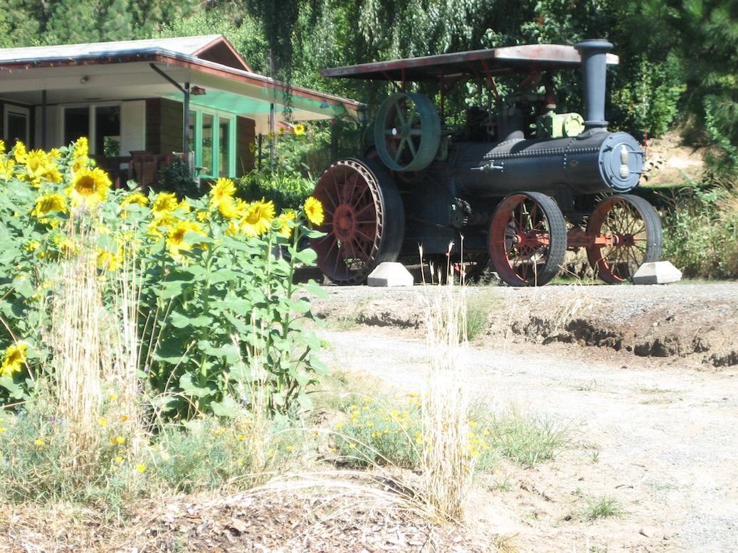
It's at Mile 9 where it seems a bit more of a climb is beginning, but it isn't until around Mile 11 that things really pick up a bit. Not that this poses much of a hurdle: Mile 12.5 is the summit, where I often pause in the shade of a turnout to ask myself "That was it, this vaunted Beaver Pass?" Well, maybe yes and maybe no, but it is the end of the uphill in the northerly direction. If wanting to turn around here, it's only downhill back to Leavenworth, something which I always find surprising since the first half-dozen miles coming out seem flat. But that makes for a 25-mile trip, with only one particularly scenic farmhouse to show for the cut between the hills attraction-wise.


Usually I at least opt for the next one-plus downhill miles to hit the town of Plain, achieved after dropping through some swoops and then one substantial hairpin turn for which I give thanks to generous paving and line painting. The town of plain offers a cafe, and thus coffee or even breakfast/lunch, but that's about it. There is something of a cowboy-esque style to its architecture, all the buildings nicely nestled in the small Beaver Valley. The place looks like a dude ranch dressed as a dollhouse - or the other way around.


With the plainness of Plain officially and rapidly discovered to any soul's content, I often stop at a backroad for the lunch I often carry. Just past "downtown" is a lone left turn one might take, onto Chapel Lane. At the end of the lane is the old wooden bridge over the Wenatchee River, closed to cars. This is also a good take-in/out spot for floating the river in season, quiet and with the pleasant reality of no cars to listen to or avoid. Another item of interest is the old barn just past the turnoff onto Chapel. It might be in the neighborhood of 100 years old, begging a sketch.

In any event, turning around at about Chapel Lane/the old barn/the right turnoff onto Chiwawa Road would make for a 28 mile trip. Here at mile 14 on the Chumstick/Route 219, those going forward have a choice. One is to stay on the main road, shortly crossing over the Wenatchee River on a big bridge to hit Lake Wenatchee in five miles. One can put in or take out a raft here as well, or put in a couple more miles down the road where there is a somewhat obvious access point to the river. Sometimes there is a conestoga wagon on display at the side of the road to break up the otherwise monotony of several miles through tenth-growth forest.
The other option is to take the Chiwawa Loop, which will also take you to Lake Wenatchee while eating up eight miles. If returning from Lake Wenatchee to Leavenworth via the Chumstick, one can mix and match between the two routes to put in 35, 38, or 41 miles. In any event, rolling a wee amount up and down the Chiwawa will take you past the massive Thousand Trails campground in a few miles, then to another bridge over the Wenatchee at mile 4. Ah, the Wenatchee River - and sometimes an inexplicably beautiful, yet completely dead, finch that might lie in the middle of the road. So it goes.


From the bridge it's another easy loping four miles, eventually passing the turnoff for Fish Lake that comes via Chiwawa Valley Road.


If you want to add up to 20 paved miles to your ride, then by all means head out this road. But you probably won't see nary a car and views a pretty much restricted to trees alongside the road. Even Fish Lake is barely seen through the trees (the photo is of the best view), and you only get a peekaboo view of some distant peaks when you top out on the steeper climbing section around mile 6. This is followed by a less appreciable decline which eventually peters out into a one lane road which itself becomes dirt after 10 miles. A gate may or may not be closed to continue at the point. I'm guessing this road rarely sees a cyclist, and when it does it's only for one occasion... like ever.
Next up, detour up Chiwawa Valley Road notwithstanding, is the Midway Store. The latter is something of a misnomer, since just a hair later the road splits between straight (North Short Lake Wenatchee) and left to another gas station/conventience store and the headwaters. Going straight can add many miles to the trip, but you'll pretty much have to come back the way you go out. Whichever way you go, Chiwawa traffic is about non-existent.


I generally go left, with the bridge of the Wenatchee River shortly found providing another place to sit around and eat or listen to music. It's just nice to get off the bike here. Within a quarter mile more is the junction with U.S.-209/Chumstick, where you can choose to go back via the Chumstick or Chiwawa Highways as measured above. Either way, it's gonna be mostly tailwinds, with the only climb being the one from Plain up to the top of Beaver Pass, a real climb if short to the tune of 10-15 minutes in length.


Otherwise it's onward to U.S.-2, which means over three miles of the straight-as-an-arrow connector road. There are some places to pull out to the right to sample Nason Creek as it feeds Lake Wenatchee, all of which I'd recommend. You can also detour into the South Shore Lake Wenatchee State Park, where you can gaze at the large, beautiful lake. Depending on when you go, it'll be empty or crowded, potentially very breezy. Being on a bike, you probably won't have to worry about an entrance fee.


Hitting U.S.-2 after those last few miles of bucolic bliss will likely remind you that yes, you ARE in a heavily-touristed area. Cole's Corner is the name of the intersection, sporting a convenience store, a diner, and something of a landscaping supply/fruit stand business to the left. Sometimes I stop in at the latter and walk about their interesting yard props, perhaps buying some fruit to munch. But, that over with, it's the big turn left onto U.S.-2 for the nearly 15 miles back to Leavenworth. One can delay the inevitable by heading straight over U.S.-2 and veering left shortly thereafter as the road bends, eventually veering left back to U.S.-2 near the old logging mill, but that doesn't add much to the trip outside of a little bit of quiet and a slightly closer look at the building with the old signs that apparently is the entire town of Winton.
U.S.-2 reminds you quickly how loud things can get, with cars ripping down the road at 60 or 70 miles an hour, perhaps newly-retired folks pulling a wide trailer for the first time. Yeah, no fun. Fortunately the shoulder is nice and wide outside of a couple very brief spots over bridges. The main bridge, the scariest section, is scheduled for replacement in September 2013. Undoubtedly it will sport a real shoulder. Whatever the case, the first five miles on U.S.-2 aren't interesting.


That changes completely when you hit the aforementioned bridge at Mile Marker 90, by the Tumwater Campground (the final float take-out spot if floating the Upper Wenatchee). The remainder of the ride is a glorious run alongside the Wenatchee River, past dead still sections that eventually lead to the rough-and-tumble Tumwater Canyon. There are pullouts galore, including some picnic spots that offer bathrooms. You can walk down to small beaches; salmon might be jumping, flashing red, or sitting just below the surface in large packs. It's all stunningly beautiful, even the fire damage from the Big One in 1994.


Even a flat doesn't change the gorgeous scenery. You can't get too upset when the river is thrushing so heavily below. This is especially true if you loaded up on some goodies at The Alps (Mile Marker 95-ish, above the dam). Chocolates, fudge, hot sauces and more are all found in quality and variety there. Consider that a plug. Consider stopping and taking in the view once, if not twice. A good place to do so is near Mile Marker 97, where a turnout drops to the right below. You can cross an old water sluice bridge on foot, then take the trail to beaches beyond and even a small tunnel which you can explore. The big rock across the way, called Castle Rock, often has climbers you can easily make out. Entertainment should never be passed up.


DIRECTIONS: Head out on the Chumstick Highway from Leavenworth. At Mile 14, you can continue on the Chumstick (route 209) until it ends at Mile 19, or take a right onto Chiwawa Road and continue until it splits eight miles later (where you'll take a left to shortly meet where Route 209 comes in from the left). This the headwaters area of Lake Wenatchee. If you came in via Route 209, turn left. Otherwise, if you came via the Chiwawa Loop, continue straight. In three miles you will hit U.S.-2 at Cole's Corner. Turn left and it's about 15 miles back to Leavenworth.
Leavenworth to Blewett Pass Out and Back, ~55 miles
Here's one that might fester for a while before you get to it. But it's worth it, what with how the pass rides always offer the call of a summit - okay, actually a saddle - to top out on. It's all about the appreciable grind of a sustained climb, no? Yes, and that's just what this one offers, although it's not particularly challenging even if it respectably goes from Leavenworth's elevation of 1200 feet to the pass's 4102. Almost 3000 feet is not a shabby feat.
Heading south and east on U.S.-2, one starts by proceeding about five miles on "The Two". That puts you just past Peshastin, where you encounter the new and improved junction with U.S. Highway 97. This used to be the Big Y, until it was redone in the late 2000s as Curcliqued Y with loops and a Park-N-Ride for no apparent reason other than to give the nearby Big Y Cafe no raison d'être. In any event, from there it's a mere twenty-one miles south to summit-ville.
As usual, the first several miles don't actually seem like climbing - certainly I can't properly tell - although they are indeed inclined in an upward way somehow. One notices the few fruit stands instead, where you can think to yourself "Just you wait..." Those peter out quickly enough, however, as the inclination of the road moves up a bit even if not substantially so. Not long after passing the other end of the dirt track that is Mountain Home Road, to the right and offering an alternative route for those in cars or on mountain bikes to return to Leavenworth, that's about it for the "civilized" part of the ride.
From there I mostly note that it's the lack of a tough climb that turns out to be the hallmark of this ride. I find it easy to stay in the saddle the entire way from Mile Markers 185 to 164 - where the Pass is. Although the lower thirteen miles are shouldered more than amply, the last eight or so miles only sport a more narrow shoulder, unfortunately. It's still respectable (safe) enough - barely.
In any event, that are no problems on the scenery score. The mountains close in after only several miles of heading south on US-97. Then they stay in that up-close-and-personal way. Large rock outcroppings, some shielded against the road with screening to keep loose debris from hitting things (like you or me), stand out. One section of creek, river or stream after another hugs one side or the other of the road, too. I don't know if the names constantly change or what, or if the roadside signs are notifying me of other creeks joining a main one, but I'm pretty sure it's Peshastin Creek that makes for the bulk of the (lower) waterway. It's all pretty, anyway!


More importantly, the road is in great shape, allowing for a nice constant spin of the wheels. Debris-wise, too, the road is generally very clear, the odd nut or bolt notwithstanding. You only have to watch out for the random (monarch) butterfly in season perhaps... or the dangers of daydreaming as you perhaps too earnestly take in the scenery.


It's probably about 10F degrees cooler at the top, so you may or may not want to hang around a long time up there - even as you'll likely enjoy the odd car that honks with a thumb's-up for the summit's effort. For all of the couple dozen minutes or so I generally take, I usually will just sit around eating the food I've packed along while overlooking a small bluff and the mountains that grow to the west of the highway. It's a modest accomplishment making it up to a pass, but it still feels good.


Going back down is a little more hairy, mostly on account of potential wind. While it might never get downright bad, you can feel a pretty good pushback on the upper miles that is exacerbated when an 18-wheeler passes by. A number might do, unfortunately. With the downhill only having one lane for cars (versus two for uphill), the cars and trucks sometimes pass a bit closer than desired, in spite of the meter or meter-and-a-half of space given to work with. Sometimes the drop to the right has a meter or so to it to think about, too. I sometimes muse on asking the dead deer I sometimes see to that side about what they think.

Perhaps for these reasons there are usually no other riders to be seen. Or maybe that's because I would choose a Wednesday for the task, a day chosen for its lower traffic in inverse proportion to its distance from the weekend. There still might be plenty - but it is nothing like weekend traffic.

On the way down, you pass again the entrance to Old Blewett Road, but I'm unsure what the outcome would be if that's used. I think it's an alternate way back over the pass toward Cle Elem. [It is.] Another section of Old Blewett Road, somewhat lower, can be seen running parallel to 97. It crumbles steadily into a tightly adjacent creek, replete with bridges knocked out. I'd thus opt for the third - and lowest - section of Old Blewett for a minor detour, about a mile of pavement that closely and quite visibly follows the highway. Not interesting, no, but it's QUIET. Eventually you are back on the main road, regaining the US-2/US-97 junction and retaking the last several miles back to town on westbound U.S.-2. Perhaps it's worth it to check and see if the bandstand has something set up for your triumphant return
DIRECTIONS: Take U.S. U.S.-2 east from Leavenworth until you reach the junction with US-97. Take a right to head south and continue on this road until you reach the pass. Rides practically can't get any simpler than this.
Leavenworth to Stevens Pass, ~70 miles
Stevens Pass was a ride that had been on my agenda for some time, the last one for me to conquer of the three nearby passes that one can head up to via paved roads from Leavenworth. Granted, Beaver Pass barely counts (A one mile section on either side of the summit is almost the full extent of "work" involved, mostly noted by the "That is it?" I ask myself each time I top out). Blewett Pass, on the other hand, proved a more worthy affair. But both demand less than what's entailed in summiting Stevens. In fact, I ultimately found that this ride is so great that it'd require two attempts - and five flats - to do it.
But direction-wise, it's the easiest - since it lies right on U.S. U.S.-2, just like Leavenworth. No turns. Traffic, however, has to be very seriously considered in this case. U.S.-2 is the next-biggest eastern-bound road outta Seattle, after I-90. This means that, on hot summer weekends, there's nothing like getting wiped out by a fleet of RVs or SUVs on stampede! (I try to not think about how much actual driving time most RV owners have under their belts.) Moreover, it's a considerably longer - and higher - haul than the joke that is Beaver and honest ol' Blewett. From Leavenworth's 1200ft-minus elevation, the Pass requires a climb of more than 3000ft. - like Blewett - but a few drops along the way mean some extra effort is necessary for regaining lost altitude. Most of the steeper stuff occurs at the end, of course: That's why they call them passes.


The first several miles of the slog are easily the most scenic, when the gorgeous features of Tumwater Canyon are up close and personal. This is why I'm almost always headed EAST on it astride my bike (as often happens when I do my Plain-Lake Wenatchee route) instead of the WESTBOUND approach that this ride entails. Still, it looks about exactly the same in either direction, a natural treasure of eye-popping beauty that's just sitting outside of town and is littered with potential hikes beyond the added amenity of a river's beaches and cool waters. In Spring and early summer, there's even gushing whitewater to appreciate.


Four or five miles into it mean passing by the small Tumwater dam, then The Alps store with its chocolates, salsas, and pickled offerings (where I've come to stop more and more regularly when driving to or from from Seattle). Glass jars and melted chocolate make it a bit less appealing on a bike. After The Alps, things begin to mellow out after passing mile marker 90 by. That comes right after crossing the bridge over the Wenatchee River, with the Tumwater Campground to the right. Up until this point it's only been a steady grind, on a smooth surface with generally generous shoulders to not realistically worry about cars at all - outside of the mile marker 87 moment, when going under a rail overpass in a brief squeeze.
It's worth noting that this is a ride best done on a Tuesday, Wednesday or Thursday. The traffic on those days isn't bad during the summer, and especially not so in this westerly direction. Anyway, five miles have become ten by the Tumwater Campground, and then there are several more flattish miles that get you past the "town" of Winton (one lumber mill going out of business, a farm or two, plus a house with old signs tacked to its exterior) and up to Cole's Corner around marker 85. There one CAN gas up - unnecessary, thank you - or perhaps buy lawn ornaments - when not rummaging through stylish landscaping supplies on the east side of the road. There's the 59er Diner if you really want to have a sit down meal, plus this is where you CAN turn off to Lake Wenatchee, bailing on the ride somewhat in returning to Leavenworth via Plain and the Chumstick Highway.
But on to the pass, right, which means the answer to bailing will be no. Continuing instead means being next rewarded with more flatness for several miles. THIS I can do for a long time, I typically muse as the flat stuff continues for a nice stretch, passing the one and only official highway rest-stop at mile marker 82. Then, at around Mile 79, the climbing finally begins a bit more in earnest... and this section of increased struggle goes for about two miles or so. It requires a bit more pumping of the pedals than previously, but a reward comes soon enough in the form of about half a mile of downhill around mile marker 76 - followed by a little more uphill and then another tiny downhill, between mile markers 74 and 73. So much for the loping part.

Now ONLY climbing is left. But the scenery improves, too, in like measure. Check out the creek down there! Well, that must've been what I was doing when I had my succession of flats the first time I tried this ride, when I was approaching Mile 71. Fortuitously, that occurred next to a lonely building at the side of the road, when any such structures have by then become few and far between. Better still, there was actually a VEHICLE sitting outside of it and, after some hapless attempts to fix my flat, it was only after I got inside that I decided to bail on the ride on my first Stevens Pass attempt. I was completely disgusted with my glass-sharded tire, but what else could I do? I was frankly ecstatic that I was allowed in to both make final attempts at flat fixing before the requisite phone call - and this in spite of all the signs that say "keep out", "no trespassing", "under video surveillance" (not to mention the barbed wire). The building is apparently owned by the BNSF railroad company, obviously an organization that doesn't take kindly to folks getting up in their bid'ness, but merely pressing the BIG RED BUTTON got me in with a smile as I met the operator of the train tunnel through the mountains. So I learned all about the twelve trains that come through daily, each requiring a venting of their gases via this very facility. Not enthralling, but interesting

It's on my second attempt that I pass by this now-former nemesis mile of marker 71. I pass it by, then 70 is history as well, on a much colder day where my iPod earphones are effectively serving as earmuffs. Mile marker 69 proves another interesting, as there is a short trail called "Bygone By-ways", the old road up the pass that is now an interpretive trail. It requires only some twenty minutes or so to take in the tiny trail's highlights. Not bad: Small waterfalls, trees, rocks - what pretty stuff at nature's door with the highway just right over... there! (I also had another flat here on the second attempt to Stevens, but no matter when such a pleasant discovery is to be made.)
But that's it for the distractions. Peaks and deep valleys suggest breadth and the closure that is the pass above. The last few miles to the pass are a bit steeper now, but at least they don't involve anything so serious that one has to remove butt from seat. In short order the pass is at hand, with the hubbub of likely vacant lots (in summer) for the large ski resort that greets you. All that's left is to go back DOWN, a proposition where you quickly drop from 4061 feet to 3600, then to 2800, then to 2200. The air temperature noticeably changes with a few thermaclines, and then eventually it's down to a lowly 1200, back in the town of Leavenworth.
DIRECTIONS: take U.S. U.S.-2 west from Leavenworth until you reach the pass. That covers the chunk between mile markers 99 (or 100 from town center) and (almost) 64. Rides can't get simpler than this, direction-wise at least.
East From Deception Falls Or So to Stevens Pass, ~14-20 miles
Stevens Pass needn't only be achieved as a road climb from the east to the west. No, there are numerous places to make the ascent from the Seattle side of the Pass as well - although only a few starting points make a lot of sense, mainly on account of how narrow the shoulder gets not terribly far from Skykomish. I reckon the three best places to start the ride are at the two entrances to the Old Cascade Highway at mile markers 55 and 58+ on Highway 2, or at Deception Falls (56+) roughly halfway between them. There is a parking lot to be had both at the easternmost of the two Old Cascade Highway entrances (at the interpretive "center", with its railcar and bathrooms) and at Deception Falls.

I'd nevertheless opt for parking at the snow chain-up area by the westernmost entrance to the Old Cascade Highway, around mile 55. That way you can enjoy the few miles of the Old Cascade Highway either coming, going, or both. It parallels Highway 2, sometimes in sight of it, along a single lane road in beautifully deep forest with often nary a car to deal with. It's only about 10 miles to the Pass from there.


This ride is both about the scenery and the climb, the latter only really picking up more steam after the hairpin turn to the left with about three miles to go from the Pass/summit of the road. There are views of deep forest and valley to the north side of the road, plus waterfalls to either depending on season. The shoulder is broad, so safety doesn't feel a great issue even as the cars go a-flying by - as they definitely do.

Achieving the pass, meanwhile, means only one thing: barreling back down! The roll will go along plenty fast if you allow it to, with a few sweeping curves to keep your brakes honest. For a greater thrill, ride closer to the barrier to your right: it's a l-o-ong way down. The best, deepest views are the highest few miles, but the nature experience is by far greater to be had in utilizing the Old Cascade Highway for its few miles at what should prove the beginning and end of the ride. It's sheer tranquility, offering stream stops to get off the bike - including a picturesque bridge spot in the middle. There's always Deception Falls to fully round out the experience, strolling over to the falls or walking the gorgeous 1/2-mile trail along the stream.
DIRECTIONS: This one is probably better done when heading to Leavenworth already from Seattle. Park at the snow chain-up area around Mile 55, at Deception Falls (Mile 56+), or the Iron Goat Interpretive Center (Mile 58+). Head east to the Pass on Highway 2 directly or, if starting at Mile 55, take the Old Cascade Highway for a few miles first before merging with Highway 2 again to head left.
A paralleling of Highway 97 to the real Blewett Pass, up and over twice, ~22 miles
Scotty Creek/Old Blewett turnoff or from 97 Rock House to add 11 miles (total) 500m from top creek alongside first mile, campspots, mining near pass when you see houses, then a big swing right followed by a last few small swing rights not a big view at pass, but a number over the next section down hairpin turn with big rock perhaps 1/3+ down 7-8 up granny gear steady 3-4 one-two above granny gear steady Here's one that might fester for a while before you get to it. But it's worth it, what with how the pass rides always offer the call of a summit - okay, actually a saddle - to top out on. It's all about the appreciable grind of a sustained climb, no? Yes, and that's just what this one offers, although it's not particularly challenging even if it respectably goes from Leavenworth's elevation of 1200 feet to the pass's 4102. Almost 3000 feet is not a shabby feat.
Heading south and east on U.S.-2, one starts by proceeding about five miles on "The Two". That puts you just past Peshastin, where you encounter the new and improved junction with U.S. Highway 97. This used to be the Big Y, until it was redone in the late 2000s as Curcliqued Y with loops and a Park-N-Ride for no apparent reason other than to give the nearby Big Y Cafe no raison d'être. In any event, from there it's a mere twenty-one miles south to summit-ville.
As usual, the first several miles don't actually seem like climbing - certainly I can't properly tell - although they are indeed inclined in an upward way somehow. One notices the few fruit stands instead, where you can think to yourself "Just you wait..." Those peter out quickly enough, however, as the inclination of the road moves up a bit even if not substantially so. Not long after passing the other end of the dirt track that is Mountain Home Road, to the right and offering an alternative route for those in cars or on mountain bikes to return to Leavenworth, that's about it for the "civilized" part of the ride.
From there I mostly note that it's the lack of a tough climb that turns out to be the hallmark of this ride. I find it easy to stay in the saddle the entire way from Mile Markers 185 to 164 - where the Pass is. Although the lower thirteen miles are shouldered more than amply, the last eight or so miles only sport a more narrow shoulder, unfortunately. It's still respectable (safe) enough - barely.
In any event, that are no problems on the scenery score. The mountains close in after only several miles of heading south on US-97. Then they stay in that up-close-and-personal way. Large rock outcroppings, some shielded against the road with screening to keep loose debris from hitting things (like you or me), stand out. One section of creek, river or stream after another hugs one side or the other of the road, too. I don't know if the names constantly change or what, or if the roadside signs are notifying me of other creeks joining a main one, but I'm pretty sure it's Peshastin Creek that makes for the bulk of the (lower) waterway. It's all pretty, anyway!


More importantly, the road is in great shape, allowing for a nice constant spin of the wheels. Debris-wise, too, the road is generally very clear, the odd nut or bolt notwithstanding. You only have to watch out for the random (monarch) butterfly in season perhaps... or the dangers of daydreaming as you perhaps too earnestly take in the scenery.
 |
 |
It's probably about 10F degrees cooler at the top, so you may or may not want to hang around a long time up there - even as you'll likely enjoy the odd car that honks with a thumb's-up for the summit's effort. For all of the couple dozen minutes or so I generally take, I usually will just sit around eating the food I've packed along while overlooking a small bluff and the mountains that grow to the west of the highway. It's a modest accomplishment making it up to a pass, but it still feels good.
 |
 |
Going back down is a little more hairy, mostly on account of potential wind. While it might never get downright bad, you can feel a pretty good pushback on the upper miles that is exacerbated when an 18-wheeler passes by. A number might do, unfortunately. With the downhill only having one lane for cars (versus two for uphill), the cars and trucks sometimes pass a bit closer than desired, in spite of the meter or meter-and-a-half of space given to work with. Sometimes the drop to the right has a meter or so to it to think about, too. I sometimes muse on asking the dead deer I sometimes see to that side about what they think.


DIRECTIONS: Take U.S. U.S.-2 east from Leavenworth until you reach the junction with US-97. Take a right to head south and continue on this road until you reach the pass. Rides practically can't get any simpler than this.
Leavenworth (- Peshastin) "Townie" Loop, ~5-15 miles
This one has turned into something of standby ride for me when I need to burn some energy. It's a loop of all of "greater" Leavenworth that can incorporate curling out to Peshastin and back. There are various places to bail out or extend the ride.


DIRECTIONS: 1) Starting from U.S.-2, head north/west to take the last left in town, onto Icicle Road.
2) Head down for over a mile-and-a-half, then take a left onto East Leavenworth Road. (Alternatively, continue for another 1/4-mile to get a coffee or treat at Sleeping Lady Resort's O'Grady's Pantry, then come back to take that turn.)


3) Follow E. Leavenworth Road for 3+ miles, admiring Icicle Ridge to the left and "Mountain Home Ridge" to the right before eventually reconnecting with U.S.-2 on the town's south side.
4-SHORT) If not feeling ambitious, take a left onto U.S.-2 to cross the river before shortly taking a right onto Chumstick Highway and then shortly thereafter again taking a left onto Fir.
4-LONG) If you want to add about 7-8 (or more) miles, instead take a right onto U.S.-2, continuing for about 4 miles to come to the traffic light that is the turnoff for Peshastin. Turn left into Peshastin, crossing under the train tracks to take an immediate left onto North Road. (Alternatively, take a right after crossing under the train tracks to do an out-and-back up Derby Canyon to add several more miles, up to the point where it becomes a dirt road.) Take North Road, loping up and down for about 4 miles to eventually hit the T at Chumstick Highway, where you take a left toward Leavenworth. Just after reentering Leavenworth, take the right onto Fir just past the high school. 5) Now on Fir, follow it immediately to the right as it changes to Pine.
6-SHORT) Stay straight on Pine, passing all the fields to your right, until you hit Ski Hill Road. Take a left.
6-LONG) At the stop sign a couple blocks later, hang a right onto Titus Road. From here you tag on 2-3 miles as you follow Titus up to Ski Hill, where it becomes Ski Hill Road as you are forced to follow it left. Continue around the bend, passing the Ski Hill "Resort"/Trail System to the right, and then roll down the hill again to properly scream into town.
7) You'll re-encounter U.S.-2 just across from my favorite cafe/restaurant, Good Mood Cafe. Eat, drink, make merry.
Wenatchee Apple Capital Loop, ~10 miles
This is about as easy as it gets, pretty much flat the entire way and a loop, as stated. It stays along the Columbia River the entire way for about five miles on either side, with two bridge crossings to do the connecting trick. There are "wilder" river access points on the east side, but more formal parks on the west side. On either side you get nice view of the sculpted and relatively bare hills around Wenatchee, revealing all of their graceful undulations. While both sides offer a number of signs for interpreting nature, the west side features many more sculptures and artistic touches.

Starting from Confluence Park, I immediately headed to the nearby Odobashian Bridge to get across to the east side:


 |
 |
The east side is a bit more rugged, then offers the panoramic view of Downtown Wenatchee with its Sage Hills backdrop to the right (Mission Ridge is out to the left a ways back):

 |
 |
 |
Yes, the right picture becomes left picture below:
|
 |
 |
Then you cross the bridge back to the west side...
 |
 |
 |
 |
 |
 |
Head through the congested area with its pile of nice sculptures until you get back to Confluence Park again, where the Wenatchee River enters into the Columbia:
 |
 |
 |
With any luck, you won't run into a hissing snake right in the trail like I did. I think it was a rattler, the way its tail shook about - but there was no rattle.
 |
 |
 |
DIRECTIONS: From Leavenworth, head to Wenatchee on U.S.-2 (about 18 miles). Within town, you can pretty much pick any of the parks that line the river, from Confluence State Park (the closest to Leavenworth) to ones Downtown, like Walla Walla Point or Wenatchee Riverfront Parks. The trail runs along the river and is easily found cutting through each. Just follow it in a loop in either direction.
 |
 |
 |
 |
 |
Yakima River Canyon, ~44 miles
This is a very straightforward ride, an out and back on the same road which makes it impossible to get lost. From Ellensburg, you would head toward Yakima on Canyon Road, parking your car around mile marker 24+ - across from the public fishing park and near the entrance sign to the canyon. Then just ride on in and take in the beautiful sights of the river cutting through the canyon.
Interesting points of note:
Launch points for floating can be found between mm 21 & 22, or using the Big Horn Access or at mm20. Good take outs can be found between, mm 5 & 6, @ "Rosa".
There is a fishing camp with coffee/restaurant between mmm 14 & 15.
The humps/climbs are found around mm14 and mm5, in both directions. Otherwise the ride mostly just lopes along easily, always in view of the river.
mm 2 might be a good place to turn around, by the entrance sign in the other direction. There's nothing more to see of interest beyond that.
Waterville/Badger Mountain Loop, ~?? miles
Badger Mountain is a loop outta Wenatchee, best done modestly planned. In other words, I did it the wrong way. Not directionwise, that part I probably did correctly, I think. But it's not to be done from 9:30-3:30 in mid-July. Think heatstroke, which I almost suffered. The routing is blessedly simple, directions-wise, starting with parking at the East Wenatchee lot for the Apple Capitol Loop. This is off 19th, near the river. From there you just make your way to the beginning of Badger Mtn Road - not far away.
The route starts with a climb of 9 miles, with the road getting ever steeper and into double digits of gradient. This section is all completely exposed to the sun - as the entire ride is. Get used to it. After the climb comes a loping 10 miles, where you generally are still climbing but quite mercifully so. At some point you suddenly top out at ??? ft. of elevation, and this is immediately followed by a 2.3mi plunge at 12%. This drops you down to plateau about Waterville; the town itself comes rather suddenly and then steadily more into view.
Somewhere during the plunge there's a turnoff for the tiny local ski resort on Badger Mountain, but that's gone by in a blip before beginning the easy couple of flat miles to dead, dead Waterville. The town is not completely devoid of charm, actually... but it's close. Think Main Street America after the ship has long sailed. The courthouse, at least, is quaint, as is a hotel suitable for a serial killer, but then that's about it for Waterville.
Leaving town on Highway 2 (west), it's a bit of a flat grade before there's a gentle rise up to 2800ft again. From there it's 6 miles of down at 6% that includes a runaway truck ramp that the local road which plunged down from Badger Mountain - again, at 12% considerably steeper - decidedly didn't have. 6% makes for a slope where you can actually pedal-assist as the cyclist sees fit. That can help to speed things along, but one thing the cyclist has no control over is the quick gain in heat in reacquiring the Columbia River at Orondo.
From Orondo there's only the road back to Wenatchee left - on US97 and US2 combined. This stretch can be quite busy in general, but there is a good shoulder to feel safe enough riding on. There's no fighting the noise of fast-traveling cars, though, so you just have to enjoy the views of the river and the bluffs across it while consciously doing a tune-out of tread-on -pavement racket. That's the way the last 15+ miles churn out, anyway, although the last 5 - starting at Rocky Reach Park - allow for the use of a much quieter cycle trail right up against the river. Still, with a theme of no tree cover, or anything else for that matter, you will continue under full sun all the way until you reach the bridge spanning over the Columbia River right on the north end of Wenatchee. From there, it's another 2 miles to the parking lot.